

Your solution for survey data governance

Capture it once. Control it forever.Unlock continuous value.
Move beyond isolated workflows and one-time deliverables. TopoShare gives you the structure, access, and control needed to operate your data as a connected, scalable system, supporting production, collaboration, and long-term value creation.

Delivering Success for Every Stakeholder.

Executives
Turn governed geospatial data into scalable, recurring value.
Program Managers
Coordinate teams, data, and costs through a shared geospatial system.
Supported Operations
Receive geospatial data, services, and deliverables where and when you need them.
Technicians
Locate, govern, and deliver geospatial data efficiently across the full lifecycle.
.png)
Executives
Turn governed geospatial data into scalable, recurring value.
Program Managers
Coordinate teams, data, and costs through a shared geospatial system.
Supported Operations
Receive geospatial data, services, and deliverables where and when you need them.
Technicians
Locate, govern, and deliver geospatial data efficiently across the full lifecycle.
"To be able to take Excel reports and basic PDF maps and turn them into an interactive visualization tool—where you see the deliverables all in one place without needing the TopoDOT software—is huge. Clients immediately told me, 'We want this every single time.'"
<script src="https://cdn.prod.website-files.com/6330c0ebacf06abbc83b6eb3/64103732523ba652052e0223_lenis-bundled.txt"></script>
<script>
class Scroll extends Lenis {
constructor() {
super({
duration: 1.5,
easing: (t) => (t === 1 ? 1 : 1 - Math.pow(2, -10 * t)), // https://easings.net
direction: "vertical",
smooth: true,
smoothTouch: false,
touchMultiplier: 1.5
}); this.time = 0;
this.isActive = true;
this.init();
} init() {
this.config();
this.render();
this.handleEditorView();
} config() {
// allow scrolling on overflow elements
const overscroll = [
...document.querySelectorAll('[data-scroll="overscroll"]')
]; if (overscroll.length > 0) {
overscroll.forEach((item) =>
item.setAttribute("onwheel", "event.stopPropagation()")
);
} // stop and start scroll btns
const stop = [...document.querySelectorAll('[data-scroll="stop"]')];
if (stop.length > 0) {
stop.forEach((item) => {
item.onclick = () => {
this.stop();
this.isActive = false;
};
});
} const start = [...document.querySelectorAll('[data-scroll="start"]')];
if (start.length > 0) {
start.forEach((item) => {
item.onclick = () => {
this.start();
this.isActive = true;
};
});
} // toggle page scrolling
const toggle = [...document.querySelectorAll('[data-scroll="toggle"]')];
if (toggle.length > 0) {
toggle.forEach((item) => {
item.onclick = () => {
if (this.isActive) {
this.stop();
this.isActive = false;
} else {
this.start();
this.isActive = true;
}
};
});
} // anchor links
const anchor = [...document.querySelectorAll("[data-scrolllink]")];
if (anchor.length > 0) {
anchor.forEach((item) => {
const id = parseFloat(item.dataset.scrolllink);
const target = document.querySelector(`[data-scrolltarget="${id}"]`);
if (target) {
//console.log(id, target);
item.onclick = () => this.scrollTo(target);
}
});
}
} render() {
this.raf((this.time += 10));
window.requestAnimationFrame(this.render.bind(this));
} /* ---- */
handleEditorView() {
const html = document.documentElement;
const config = { attributes: true, childList: false, subtree: false }; const callback = (mutationList, observer) => {
for (const mutation of mutationList) {
if (mutation.type === "attributes") {
const btn = document.querySelector(".w-editor-bem-EditSiteButton");
const bar = document.querySelector(".w-editor-bem-EditorMainMenu");
const addTrig = (target) =>
target.addEventListener("click", () => this.destroy()); if (btn) addTrig(btn);
if (bar) addTrig(bar);
}
}
}; const observer = new MutationObserver(callback);
observer.observe(html, config);
}
}window.SmoothScroll = new Scroll();
</script>
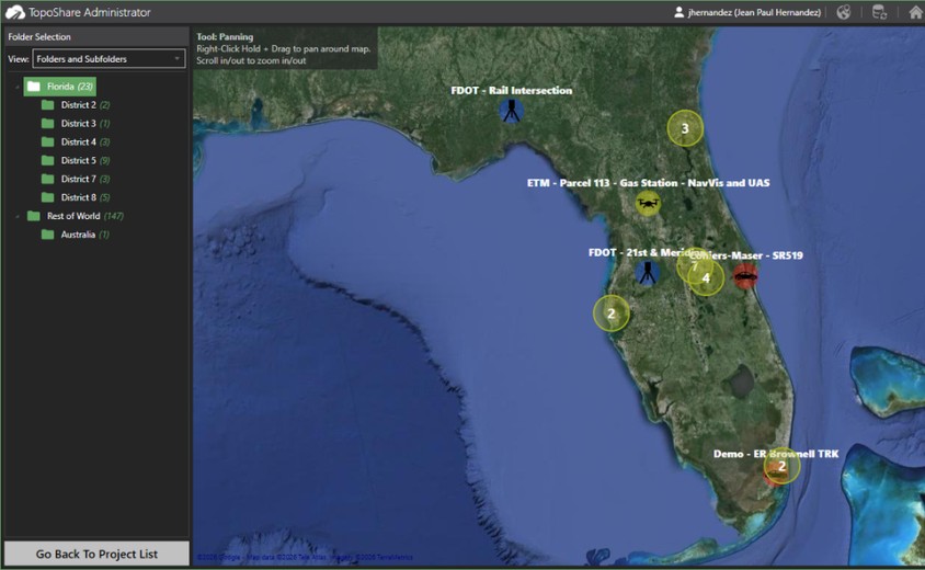
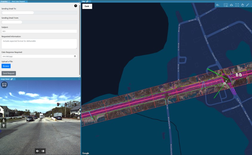
Your Interactive Data Catalog
Map-Based Data Access
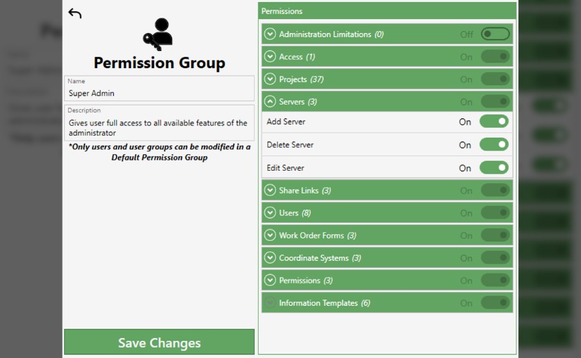
Granular Access Control
Cloud-Native Data Warehouse Integration
On-Demand Data Discovery & Requests

Map-Based Data Access
Granular Access Control

Cloud-Native Integration

On-Demand Discovery
Real Support. Real Expertise.
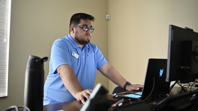
Real Support From Industry Professionals
When you need help, give us a call.Talk to real people who understand geospatial production workflows, not a generic support queue.
.jpg)
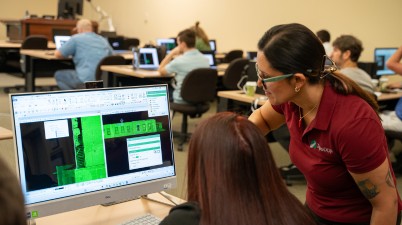
On-Demand Learning and Documentation
Access a comprehensive knowledge base, detailed help articles, and a full training library through TopoDOT University to support your team at every stage.
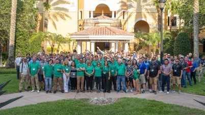
An Active User Community
Join a global network of TopoDOT users who share knowledge, attend webinars, and collaborate on best practices across projects and industries.
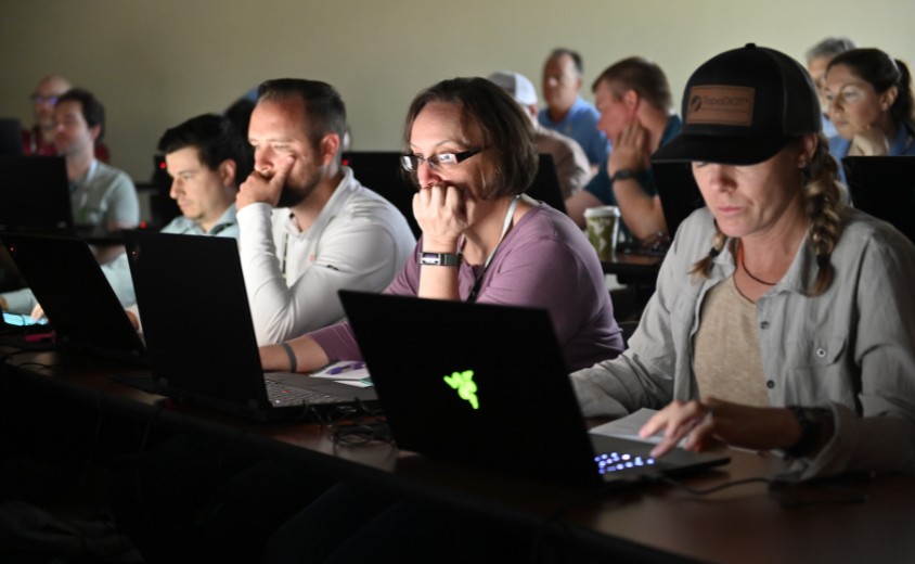
Hands-on Training & Partnership
Go deeper with tailored training and consulting engagements designed to help your team implement workflows, improve efficiency, and get more value from the platform.
Start Managing Your Survey Data Like an Asset
Learn more about the only platform purpose-built to govern survey data efficiently and at scale.

Software, data governance, training, and consulting support for organizations that work with point cloud production at scale.

.png)

Winter Garden, FL 34787

